


As artificial intelligence (AI), satellite technology, and geospatial analytics continue to reshape agriculture, data-driven intelligence is emerging as a powerful enabler of precision farming and agricultural risk management. By combining satellite imagery, machine learning, weather data, and advanced analytics, agritech innovators are helping farmers monitor crop health, assess soil conditions, optimise irrigation, and make more informed decisions. At the same time, satellite-driven insights are creating new opportunities for banks and insurers to evaluate agricultural risks, monitor farmland, and strengthen data-driven lending and insurance processes.
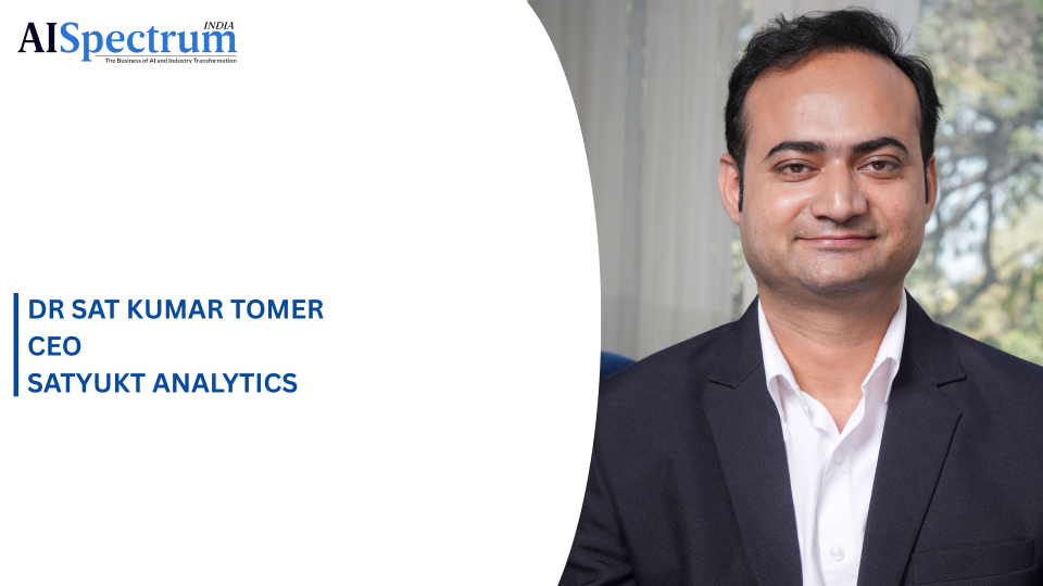
In this edition of AI Spectrum, we speak with Dr. Sat Kumar Tomer, Founder and CEO of Satyukt Analytics Private Limited, about how AI-powered geospatial intelligence is transforming agricultural decision-making. Dr. Tomer discusses the capabilities of Satyukt’s Sat2Farm platform, the role of machine learning in translating complex satellite observations into actionable field-level insights, and the challenges of developing reliable AI models across diverse crops, geographies, and environmental conditions. He also explores how the company’s Sat4Risk platform supports agricultural risk assessment for financial institutions and shares his perspective on the future of predictive and automated precision agriculture.
From improving resource efficiency and strengthening climate resilience to enabling scalable agricultural intelligence across more than 150 crop types and 50 countries, the conversation examines how the convergence of AI and satellite technology can help build a more informed, efficient, and resilient agricultural ecosystem.
How Does Satyukt Analytics Combine Satellite Imagery, Machine Learning, and Other Agricultural Data Through Its Sat2Farm Platform to Generate Near-Real-Time Insights on Crop Health, Water Stress, and Farm Conditions?
Every Sat2Farm analysis begins with the field boundary. Satellite imagery is processed for that specific plot, allowing agricultural information to be linked to a defined area while enabling spatial variations within the field to be analysed, subject to the resolution of the available satellite data. Geospatial analytics help organise and analyse satellite observations at the field level, while machine learning interprets these signals in the context of the crop, season and prevailing environmental conditions.
For soil health, we derive satellite-based estimates of nitrogen, phosphorus, potassium, soil organic carbon and pH. For crop health, we track the Normalized Difference Vegetation Index (NDVI) over time to identify potential vegetation stress. These observations help indicate where closer assessment may be required, while additional weather, crop and field-level information supports the interpretation of possible causes and informs pest and disease forewarning and image-based advisory.
For irrigation management, we provide satellite-derived soil moisture information alongside weather data to support irrigation advisories. Weather forecasts, the Land Surface Water Index (LSWI) and crop calendars add environmental and crop-growth context to these observations. By combining these different information sources, Sat2Farm helps farmers better understand changing field conditions and make timely, informed agricultural decisions.
Satellite Imagery Can Generate Large Volumes of Complex Geospatial Data. What Role Do AI and Machine Learning Play in Processing, Interpreting, and Converting This Data Into Actionable Insights for Farmers and Other Agricultural Stakeholders?
At Satyukt, AI and machine learning help us transform complex satellite imagery into actionable agricultural intelligence at the field level. These technologies enable us to analyse satellite observations, recognise patterns and track changes in crop and soil conditions over time.
Processing large volumes of geospatial data requires reliable computing and storage infrastructure. Cloud computing infrastructure can support the storage of satellite data and provide the computational resources required to process observations and run analytical models at scale.
By combining satellite observations with relevant weather and agricultural data, our models generate estimates of soil properties, moisture conditions and crop health. Analysing patterns across multiple observations helps identify spatial variations and potential crop stress that might otherwise go unnoticed.
Through Sat2Farm, we make these insights accessible to farmers and agricultural advisors, helping them make informed decisions based on field conditions. Agribusinesses can use satellite-derived agricultural intelligence to monitor crops across multiple locations, while banks and insurers can draw on related capabilities through Satyukt's broader technology portfolio to support agricultural risk assessment.
Ultimately, AI and machine learning help bridge the gap between raw satellite data and practical agricultural decisions. Combined with scalable computing and storage infrastructure, they enable us to deliver relevant insights to different agricultural stakeholders across large geographical areas.
How Does Sat2Farm Use AI Models to Account for Variations Across Different Crops, Geographies, Soil Conditions, and Weather Patterns, Particularly Given Its Deployment Across More Than 150 Crops and 50 Countries?
At Satyukt, AI and machine learning help interpret satellite observations in the context of different crops, geographical locations, soil conditions and weather patterns. The same satellite signal can indicate different crop conditions depending on the crop type, growth stage and surrounding environment. For example, an NDVI value may have different implications for crop health across different regions and growing conditions.
AI models help analyse patterns in satellite-derived indicators and identify variations in crop and soil conditions. By analysing satellite observations alongside relevant agricultural and environmental data, these models help make the resulting insights more meaningful for different farming contexts.
This is particularly important because rainfall, temperature, soil characteristics and farming practices vary across regions, influencing crop growth and the signals captured by satellites. Developing reliable models requires accounting for these variations to ensure that insights remain relevant across different agricultural conditions.
With Sat2Farm supporting more than 150 crop types and Satyukt's agricultural intelligence solutions reaching over 50 countries, the challenge is to interpret satellite data in context rather than apply a single, universal interpretation. By combining AI-driven analysis with relevant agricultural and environmental information, Sat2Farm helps farmers and agricultural advisors better understand field conditions and make informed decisions.
Beyond Farm Monitoring, How Are AI-Driven Satellite Insights Helping Banks and Insurers Assess Agricultural Risk, Evaluate Farmland, and Make More Data-Driven Lending and Insurance Decisions?
Banks and insurers are often required to assess thousands of farms and properties without being able to physically inspect every location. Satyukt's Sat4Risk platform addresses this challenge by converting satellite observations into location-specific risk information that can support assessments at the beginning of a loan or insurance policy and throughout its lifecycle.
For agricultural risk assessment, satellite-derived information can help institutions evaluate exposure to hazards such as floods, droughts and rainfall variability. For lenders, this provides an additional evidence base for assessing agricultural exposure, supporting more informed underwriting and potentially reducing the need for repeated physical verification.
Beyond initial assessment, satellite-based farm monitoring allows banks and insurers to observe changing conditions across agricultural portfolios throughout the growing season. Information on crop health, vegetation condition, soil moisture, soil health and estimated crop yields can help identify areas experiencing agricultural stress. This enables institutions to prioritise locations requiring closer examination and direct field verification towards areas where additional evidence is needed.
Satellite-derived intelligence can also contribute to property risk assessment by examining environmental and location-related factors such as weather patterns, drainage proximity and surrounding land-use changes. These observations provide additional context when evaluating risks associated with land or property used as collateral.
The primary advantage is the ability to establish a consistent and repeatable source of information across large geographical areas. Rather than replacing physical inspections, field assessments or established underwriting procedures, satellite intelligence complements them with timely, location-specific evidence. This can help banks and insurers make better-informed lending, monitoring and insurance decisions.
What Are the Key Challenges in Developing Reliable AI Models for Agriculture, Particularly Around the Availability and Quality of Labelled Data, Changing Environmental Conditions, Cloud Cover in Satellite Imagery, and the Need to Validate Satellite-Derived Insights Against Ground-Level Conditions?
AI and machine learning offer significant potential to make agriculture more data-driven and precise. However, developing reliable AI models requires addressing several challenges to ensure that satellite-derived insights remain accurate across different agricultural conditions.
Availability and quality of labelled data are important challenges. Developing reliable agricultural AI models requires reference information such as crop types, field observations, soil measurements and verified agricultural conditions. Obtaining sufficiently representative datasets across different regions, seasons and crops can be difficult. Incomplete or inconsistent labels may affect model training and reduce the reliability of predictions.
Changing environmental conditions present another challenge. Variations in weather, soil types, crop varieties and farming practices can influence crop growth and satellite observations, affecting model performance across regions and seasons. Models therefore need to account for environmental variability rather than rely on patterns observed under a limited set of conditions.
Cloud cover in optical satellite imagery can obstruct observations of the Earth's surface, making it difficult to obtain clear and consistent information for crop monitoring. Microwave-based satellite observations, including Synthetic Aperture Radar (SAR), can help address this limitation by providing observations through cloud cover and during periods of reduced visibility. However, interpreting radar observations also requires appropriate processing, calibration and validation.
Ground-level validation remains essential for assessing the reliability of satellite-derived insights. Comparing model outputs with field observations, soil tests and other ground-level measurements helps evaluate accuracy, identify discrepancies and determine where improvements are required.
Regional variability and model generalisation are equally important when expanding into new geographical areas. A model trained on data from one region may perform well under familiar conditions but deliver less reliable results in another region with different crops, soil characteristics or climatic conditions. Incorporating representative local data and validating model performance can help determine whether additional training or adaptation is necessary.
Addressing these challenges through continuous validation, representative data collection and model refinement helps improve the reliability of AI-driven agricultural insights. The objective is to develop models that remain scientifically dependable and practically relevant across diverse crops, seasons and agricultural environments.
Looking Ahead, How Do You See Advances in AI, Satellite Technology, and Geospatial Analytics Transforming Precision Agriculture, and What Capabilities Will Be Needed to Enable Increasingly Predictive and Automated Farm-Level Decision-Making?
Looking ahead, advances in AI, satellite technology and geospatial analytics will make precision agriculture more predictive, automated and accessible. As AI models improve and satellite observations become more frequent and detailed, farmers will be better positioned to understand crop conditions, monitor soil moisture and identify emerging agricultural risks before they become more severe.
For example, the NASA-ISRO Synthetic Aperture Radar (NISAR) mission provides repeated radar observations with a 12-day repeat cycle and approximately six-day average sampling. ISRO has also demonstrated high-resolution soil moisture products derived from NISAR observations. Such developments can strengthen agricultural monitoring by improving the availability of information about surface soil moisture, supporting irrigation planning, drought preparedness and agricultural decision-making.
Another important development will be the integration of historical observations with current field conditions to generate increasingly predictive insights. Rather than only identifying existing crop stress, AI-driven systems could help anticipate potential water shortages, changing crop conditions and weather-related risks. This would allow farmers and agricultural stakeholders to plan interventions earlier and allocate resources more effectively.
The key capabilities needed will be scalability, to extend these solutions across millions of farms; affordability, to make agricultural intelligence accessible to smallholder farmers; reliable predictive analytics, to identify emerging risks; and continuous validation, to ensure that model outputs remain relevant across different crops, regions and environmental conditions.
Equally important will be converting complex scientific information into simple, timely recommendations that farmers can understand and act upon. The future of precision agriculture will depend not only on advances in AI and satellite technology but also on how effectively these capabilities translate into practical farm-level decisions, improved resource management and more resilient agricultural practice